 EMODnet Product Catalogue
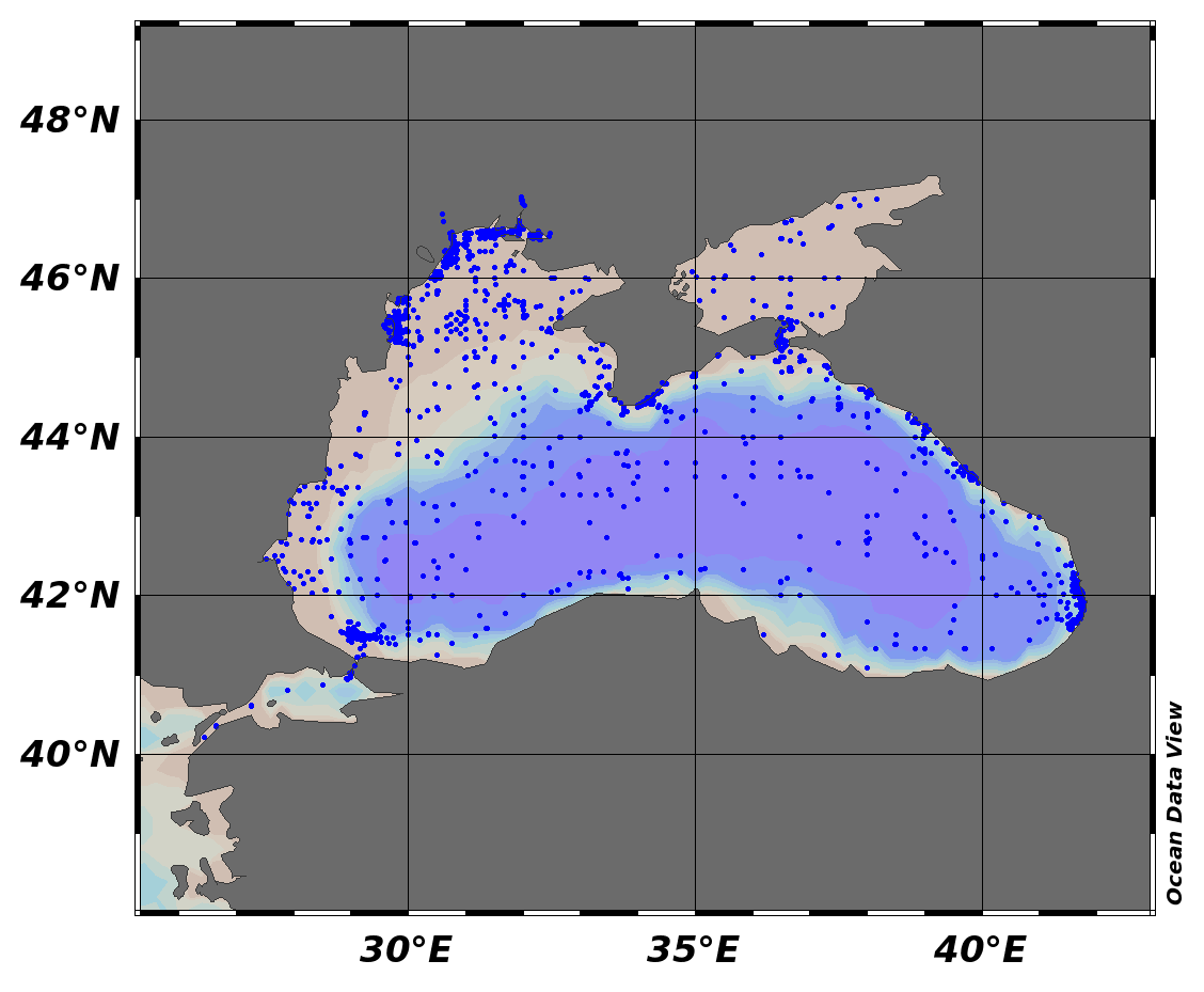
Concentration of suspended particulate material in the water column
Type of resources
Available actions
Topics
Keywords
Contact for the resource
Provided by
Years
Formats
Representation types
-
EMODnet Chemistry aims to provide access to marine chemistry data sets and derived data products concerning eutrophication, ocean acidification and contaminants. The chemicals chosen reflect importance to the Marine Strategy Framework Directive (MSFD). This regional aggregated dataset contains all unrestricted EMODnet Chemistry data on contaminants (48 parameters), and covers the Black Sea with 21504 CDI records divided per matrices: 7 biota profiles, 19677 water profiles, 1820 sediment profiles. Vertical profiles temporal range is from 1974-08-24 to 2017-10-06. Data were aggregated and quality controlled by ‘National Institute for Marine Research and Development "Grigore Antipa"’ from Romania. Regional datasets concerning contaminants are automatically harvested. Parameter names in these datasets are based on P01, BODC Parameter Usage Vocabulary, which is available at: http://seadatanet.maris2.nl/bandit/browse_step.php . Each measurement value has a quality flag indicator. The resulting data collections for each Sea Basin are harmonised, and the collections are quality controlled by EMODnet Chemistry Regional Leaders using ODV Software and following a common methodology for all Sea Regions. Harmonisation means that: (1) unit conversion is carried out to express contaminant concentrations with a limited set of measurement units (according to EU directives 2013/39/UE; Comm. Dec. EU 2017/848) and (2) merging of variables described by different “local names”, but corresponding exactly to the same concepts in BODC P01 vocabulary. The harmonised dataset can be downloaded as ODV spreadsheet (TXT file), which is composed of metadata header followed by tab separated values. This worksheet can be imported to ODV Software for visualisation (More information can be found at: https://www.seadatanet.org/Software/ODV ). The same dataset is offered also as XLSX file in a long/vertical format, in which each P01 measurement is a record line. Additionally, there are a series of columns that split P01 terms in subcomponents (measure, substance, CAS number, matrix...).This transposed format is more adapted to worksheet applications users (e.g. LibreOffice Calc). The 48 parameter names in this metadata record are based on P02, SeaDataNet Parameter Discovery Vocabulary, which is available at: http://seadatanet.maris2.nl/v_bodc_vocab_v2/vocab_relations.asp?lib=P02 . Detailed documentation will be published soon. The original datasets can be searched and downloaded from EMODnet Chemistry Download Service: https://emodnet-chemistry.maris.nl/search
-

EMODnet Chemistry aims to provide access to marine chemistry data sets and derived data products concerning eutrophication, ocean acidification and contaminants. The chemicals chosen reflect importance to the Marine Strategy Framework Directive (MSFD). This regional aggregated dataset contains all unrestricted EMODnet Chemistry data on contaminants (59 parameters), and covers the North Sea with 34978 CDI records divided per matrices: 3909 biota time series, 28071 water profiles, 2998 sediment profiles. Vertical profiles temporal range is from 1970-02-17 to 2017-10-26. Time series temporal range is from 1979-02-26 to 2017-02-28. Data were aggregated and quality controlled by ‘Aarhus University, Department of Bioscience, Marine Ecology Roskilde from Denmark. Regional datasets concerning contaminants are automatically harvested. Parameter names in these datasets are based on P01, BODC Parameter Usage Vocabulary, which is available at: http://seadatanet.maris2.nl/bandit/browse_step.php . Each measurement value has a quality flag indicator. The resulting data collections for each Sea Basin are harmonised, and the collections are quality controlled by EMODnet Chemistry Regional Leaders using ODV Software and following a common methodology for all Sea Regions. Harmonisation means that: (1) unit conversion is carried out to express contaminant concentrations with a limited set of measurement units (according to EU directives 2013/39/UE; Comm. Dec. EU 2017/848) and (2) merging of variables described by different “local names” ,but corresponding exactly to the same concepts in BODC P01 vocabulary. The harmonised dataset can be downloaded as ODV spreadsheet (TXT file), which is composed of metadata header followed by tab separated values. This worksheet can be imported to ODV Software for visualisation (More information can be found at: https://www.seadatanet.org/Software/ODV ). The same dataset is offered also as XLSX file in a long/vertical format, in which each P01 measurement is a record line. Additionally, there are a series of columns that split P01 terms in subcomponents (measure, substance, CAS number, matrix...).This transposed format is more adapted to worksheet applications users (e.g. LibreOffice Calc). The 59 parameter names in this metadata record are based on P02, SeaDataNet Parameter Discovery Vocabulary, which is available at: http://seadatanet.maris2.nl/v_bodc_vocab_v2/vocab_relations.asp?lib=P02 . Detailed documentation will be published soon. The original datasets can be searched and downloaded from EMODnet Chemistry Download Service: https://emodnet-chemistry.maris.nl/search
-

EMODnet Chemistry aims to provide access to marine chemistry data sets and derived data products concerning eutrophication, ocean acidification and contaminants. The chemicals chosen reflect importance to the Marine Strategy Framework Directive (MSFD). This regional aggregated dataset contains all unrestricted EMODnet Chemistry data on contaminants (20 parameters), and covers the North East Atlantic Ocean with 2400 CDI records divided per matrices: 122 in biota (as time series), 1689 in water (as vertical profiles), 589 in sediment (478 Vertical profiles and 111 Time series). Vertical profiles temporal range is from 1970-07-29 to 2017-02-28. Time series temporal range is from 1979-02-28 to 2014-10-21. Data were aggregated and quality controlled by ‘IFREMER / IDM / SISMER - Scientific Information Systems for the SEA’ from France. Regional datasets concerning contaminants are automatically harvested. Parameter names in these datasets are based on P01, BODC Parameter Usage Vocabulary, which is available at: http://seadatanet.maris2.nl/bandit/browse_step.php . Each measurement value has a quality flag indicator. The resulting data collections for each Sea Basin are harmonised, and the collections are quality controlled by EMODnet Chemistry Regional Leaders using ODV Software and following a common methodology for all Sea Regions. Harmonisation means that: (1) unit conversion is carried out to express contaminant concentrations with a limited set of measurement units (according to EU directives 2013/39/UE; Comm. Dec. EU 2017/848) and (2) merging of variables described by different “local names” ,but corresponding exactly to the same concepts in BODC P01 vocabulary. The harmonised dataset can be downloaded as ODV spreadsheet (TXT file), which is composed of metadata header followed by tab separated values. This worksheet can be imported to ODV Software for visualisation (More information can be found at: https://www.seadatanet.org/Software/ODV ). The same dataset is offered also as XLSX file in a long/vertical format, in which each P01 measurement is a record line. Additionally, there are a series of columns that split P01 terms in subcomponents (measure, substance, CAS number, matrix...).This transposed format is more adapted to worksheet applications users (e.g. LibreOffice Calc). The 20 parameter names in this metadata record are based on P02, SeaDataNet Parameter Discovery Vocabulary, which is available at: http://seadatanet.maris2.nl/v_bodc_vocab_v2/vocab_relations.asp?lib=P02 . Detailed documentation will be published soon. The original datasets can be searched and downloaded from EMODnet Chemistry Download Service: https://emodnet-chemistry.maris.nl/search
-
Repeat hydrography, as organized through the GO-SHIP network, is fundamental for detecting trends and variability also in the Mediterranean Sea. The Mediterranean component of GO-SHIP is MedSHIP, and TAlPro is the western Mediterranean component. The TAlPro2022 cruise consisted of 26 full depth hydrographic stations crossing the Tyrrhenian Sea from north to south, then the Algero-Provencal Basin from south to north. Here the postcalibrated bottle file data are made availiable. Postcalibration has been done by measuring dissolved oxygen and salinity on water samples collected by the rosette. The dataset contains also all chemical variables, measured in the lab.
-
Samples collected from an underway Towfish during RV Sanna cruise GLICE (August 2022) and either analysed at sea or returned preserved to GEOMAR for analysis. Sensor data refers to in-line data matching the underway samples.
-
Chemical data from water samples taken in Mersin Bay in 2022 in framework of the project "Ecosystem Based Monitoring and Management Plan for the Clean Mediterranean, Phase 1"
-
Particulate matter and particulate organic carbon concentrations (PMC and POC, respectively) in the frame of HERMES project
-
Data were collected in the southern Western Black Sea (Bulgarian and Romanian territorial waters) for the Eurofleets+ PHYCOB cruise. This submission contains CTD and nutrient data. The main scientific objectives of the research cruise are: 1) To assess the presence of toxic microalgae in the plankton assemblage of the Western Black Sea. 2) To quantitatively determine the spatial distribution of toxic phytoplankton species and their corresponding toxins in the plankton. 3) To quantitatively describe the spatial distribution of toxic phytoplankton resting stages in surface sediments and determine hotspots of recruitment and bloom initiation. 4) To define correlations among hydrographic and/or meteorological conditions and occurrence of HAB species. 5) To characterize the plankton communities accompanying HAB species together with toxin analysis of size fractionated samples. 6) To identify heterotrophic dinoflagellates, ciliates, or other small zooplankton as possible toxin vectors. 7) To isolate toxic Black Sea microalgal species and establish monoclonal cultures for characterization of Black Sea strains. 8) To perform an interseasonal comparison of toxigenic plankton species by combining the data sets collected during the R/V Akademik cruise that was performed in May/June 2019 with our data from summer. 9) To compare the data set from the Western Black Sea to the Southern (North-) Western North Sea, Baltic Sea and West Greenland obtained during earlier expeditions for site comparisons.
-
The objective of the TONGA oceanographic expedition was to study the control of productivity and carbon sequestration by micronutrients of shallow hydrothermal origin in the Western Tropical South Pacific (WTSP) Ocean. The 37-day oceanographic survey took place on board the R/V L’Atalante in 2019 between Oct. 31 to Dec. 6 (Nouméa-Nouméa). Over a large area of the WTSP the team acquired numerous results on both the entire water column (up to the sediment) and the atmosphere. Specific task are represented on figure 1: (task 1) to characterize chemically and optically shallow hydrothermal fluids and to compare the source from below (shallow hydrothermal fluids) with the source from above (atmospheric deposition); (task 2) to quantify the dynamical dispersion of the fluids at small and regional scale; (task 3) to investigate the impact of the shallow hydrothermal sources on the biological activity and diversity, and the feedback to the atmosphere via the oceanic emissions of primary and secondary aerosols. (Task 4) to communicate about the campaign (see for example our Tweeter account (https://www.youtube.com/watch?v=UeABf-cVR-k). A long west to east (up to the blue waters of the gyre) transect allowed to characterize the different biogeochemical provinces crossed and a focus in the region of the Lau Basin allowed to investigate the impact of shallow hydrothermal sources. A series of short and long stations allowed to fully characterize the stocks and the fluxes in the different provinces. Short-term (up to 10 days) processes studies have been conducted (drifting moorings and minicosms experiments). Part of these results will feed into important modeling work. A fixed mooring line launched at the end of the campaign and recovered in Nov. 2020 as well as the 7 ARGO floats and 20 drifting buoys that were dropped during the campaign provide a broader temporal context of the acquisitions done during the campaign. An important focus of the campaign was the trace metal characterization of the entire water column. For this, TONGA has been labeled by the international program GEOTRACES (https://www.geotraces.org/). The impact on biological communities of fluids is supported by the international IMBER program (https://imber.info/). The TONGA project is also part of the LEFE program (funding by LEFE-CYBER and LEFE-GMMC), the ANR (Appel à projets génériques) and the Fondation A-MIDeX of the Aix-Marseille Université. Scheme of the different tasks of the TONGA project and cruise Image Reference: https://www.seanoe.org/data/00770/88169/illustrations/illustration-148.gif. Important Note: This submission has been initially submitted to SEA scieNtific Open data Edition (SEANOE) publication service and received the recorded DOI. The metadata elements have been further processed (refined) in EMODnet Ingestion Service in order to conform with the Data Submission Service specifications.
-
Gironde estuary environmental parameters and SPM maps generated from 41 Landsat-8/OLI and Sentinel-2/MSI images acquired over the period 2013-2018. Except bathymetry and daily river discharge data, that are accessible on public platforms, the dataset includes all of the time seris used in the publication: Analysis of suspended sediment variability in a large highly-turbid estuary using a 5-year-long remotely-sensed data archive at high resolution, Journal of Geophysical Research: Oceans, (DOI:10.1029/2019JC015417)-[https://doi.org/10.1029/2019JC015417]. Important Note: This submission has been initially submitted to SEA scieNtific Open data Edition (SEANOE) publication service and received the recorded DOI. The metadata elements have been further processed (refined) in EMODnet Ingestion Service in order to conform with the Data Submission Service specifications.